Laser cut city maps with streets that hold together
A laser cut city map lives or dies on its streets. Too many and it reads as a smudge. Too thin and they snap. Unconnected and they fall out of the machine. MappSmith pulls real street data from OpenStreetMap, already vector, sorts it into road groups, and welds the cut streets to a frame band so nothing floats.
7 days free, then $12 a month. Cancel anytime. Or 10 maps for $10.
- Layered sizes
- 8, 10, 12, 16, 18 in squares
- Default
- 10 in
- Layers
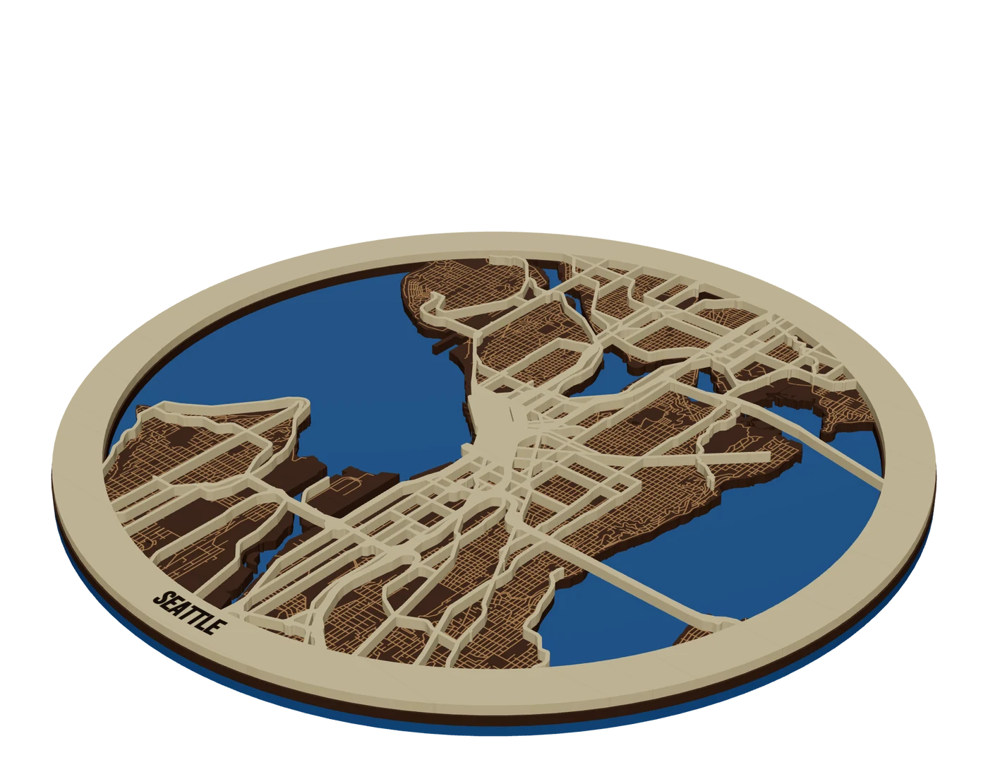
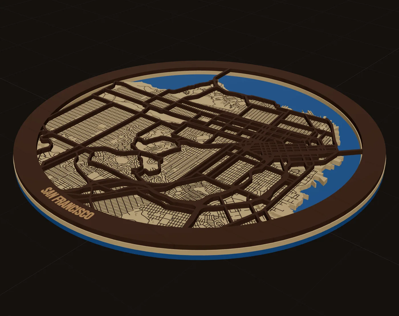
- 3 (water, land, roads)
- Line width
- 0.05 to 3 mm per road group
- Files
- SVG per layer + .lbrn2, .xs, DXF
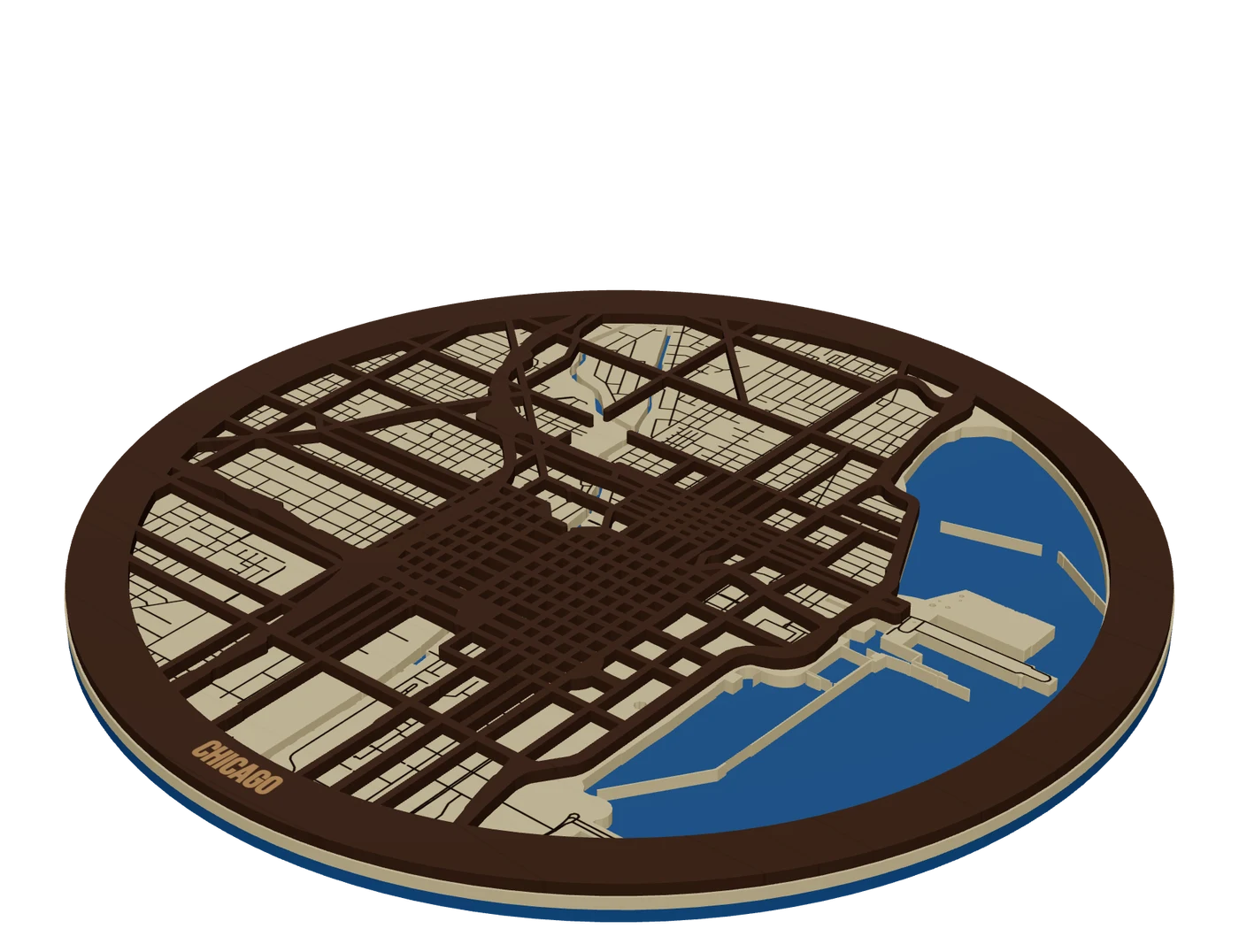
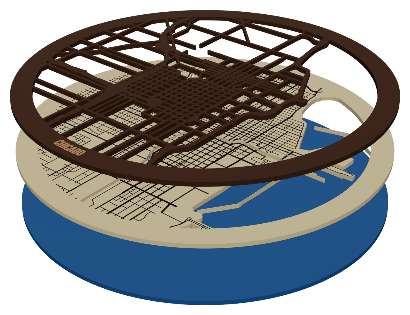
The layers, top to bottom
- RoadsWalnut, 3 mmPieces only: major streets cut out and welded to the frame band
- LandMaple or birch, 3 mmSolid plate, water cut out, minor streets and the name engraved
- WaterBlue acrylic, 3 mmSolid base that shows through every river, lake and bay
Street hierarchy: decide what each road does
The manual way makes you sort roads by hand. One maker pulling a neighborhood from OpenStreetMap through QGIS and Inkscape called it "quite a lot of manual labor." Another got 146,696 objects from one Manhattan export, and ungrouping them ran overnight. MappSmith groups roads for you: Interstates and highways, Main roads and avenues, Local streets, Driveways and lanes, and Walking and bike paths.
| Road group | Good default | Why |
|---|---|---|
| Interstates and highways | Cut, on the top layer | The skeleton people recognize |
| Main roads and avenues | Cut on top, or scored | Adds the grid without clutter |
| Local streets | Engraved on the land layer | Texture, not structure |
| Driveways, lanes, paths | Off | Too fine to cut, noisy when engraved |
Each group gets one operation and one width. That matters because map data changes a road's type along its length. If the highway and its exit ramp had separate settings, a cut road could end in mid-air.
One maker's tip from her LightBurn city map build: score roads instead of engraving them. It's faster and the roads stand out more.
Solid plate vs pieces only
Every layer has a Body setting. Solid plate is the whole sheet with shapes cut or engraved into it. Pieces only keeps just the shapes, like the street network, held together by the frame band. Frame only is the band with the middle removed.
A pieces-only street layer on its own was "too floppy" in one maker's build, and edge pieces became islands that fell off. Her fix was to merge the road ends into an outer frame. MappSmith does that weld on export. If any piece would still be attached to nothing, the download stops and tells you, rather than handing you a file that cuts into loose parts. Add another road group so the network joins up, or widen the band.
Let the water show through, add parks
Water is what makes a city map readable from across the room. Cut the rivers, lakes and bays out of the land layer and a blue acrylic base shows through. If you'd rather paint the water, one maker uses 1/8 inch MDF for the painted base because thin plywood tends to warp when painted on one side.
The City + parks style engraves parks and green space onto the land layer. The Detailed style adds filled parks and engraved buildings. Buildings are a lot of burn time at city scale, so save them for small, dense downtowns.
Crop to something people recognize: a shoreline, a river bend, the street grid, a downtown. A test map at one makerspace got blunt feedback: "what's a map without street names." Put the city name, coordinates or a date on the frame band so the piece explains itself.
The three layer model, cut by cut
- Frame the citySearch the place, pick circle, square, heart or a state outline, and set the finished size.
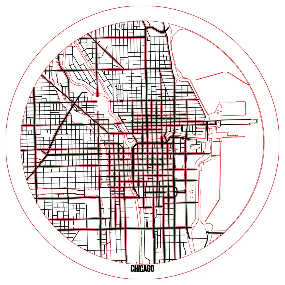
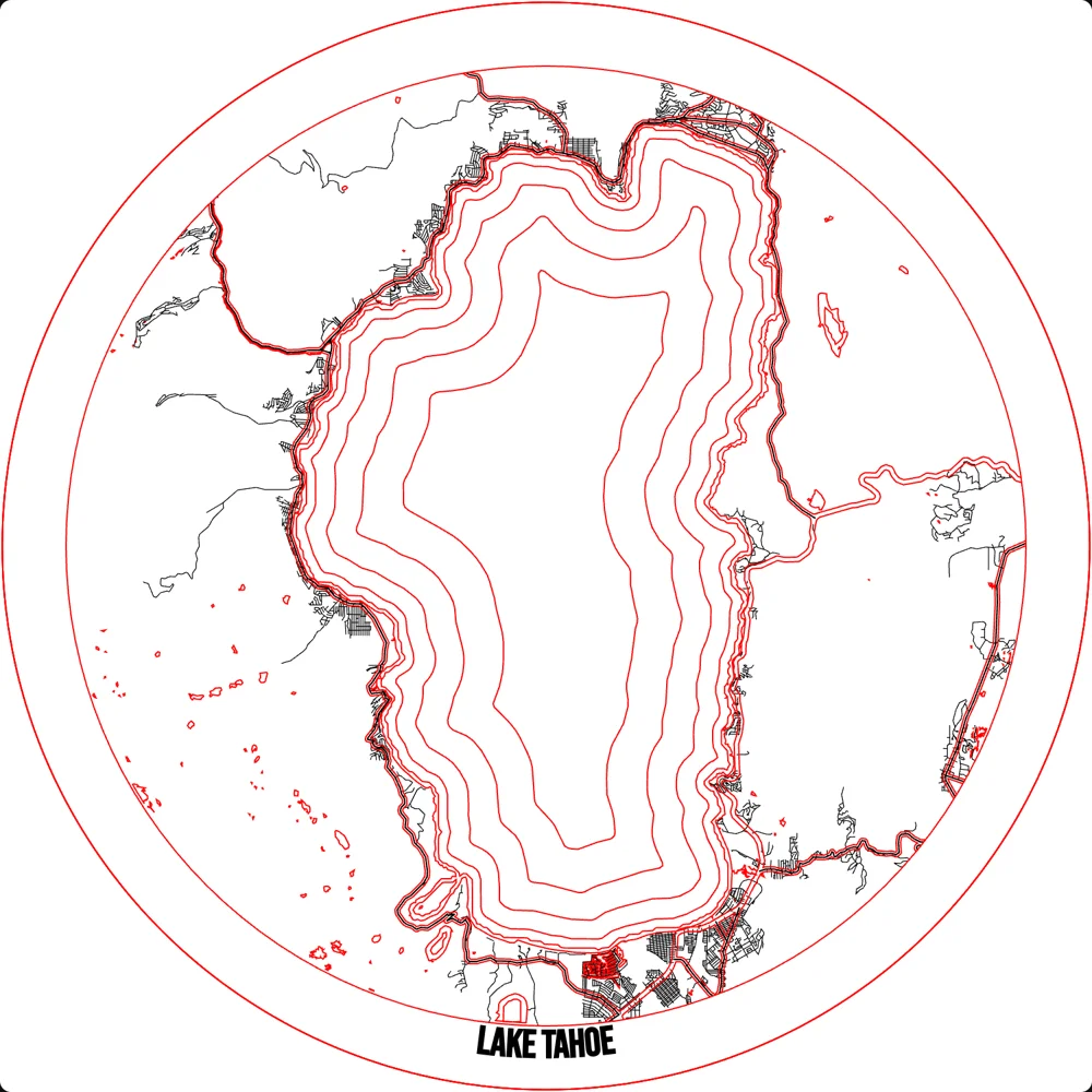
- Check each sheetThe "This sheet" picture shows one layer exactly as it comes off the machine. An amber warning means a layer would cut blank.
- Preview in 3DLeave Welded on. It shows pieces joined the way the export cuts them, and warns about anything loose.
- DownloadOne SVG per physical layer, plus LightBurn, xTool or DXF if you tick them. Files are millimetres at finished size.
- Cut and glueGlue land onto the blue base so the water shows, then the street layer on top, lining its frame up with the land edge.
Test on cardboard or chipboard before you cut good stock. It's cheap and it shows you which streets are too thin for your machine.
What makers charge for a laser cut city map
For reference: one seller lists a personalized layered wood map at $89 with free US shipping, and a Milwaukee map at $159 in sizes from 11x14 to 34x34. Price climbs with size, layer count and framing. Credit "© OpenStreetMap contributors" on the listing and packaging (how).
Questions makers ask
Can I get a city map SVG for laser cutting?
Yes. Every download includes one layered SVG per physical layer, with cut in red, score in blue and engrave in black. LightBurn, xTool and DXF files are optional extras.
How thin can a cut street be?
Not thinner than your kerf, which runs about 0.2 to 1 mm depending on the process and material. Line widths in MappSmith go from 0.05 to 3 mm, so set cut roads well above your kerf and test.
Why do my map pieces fall out?
They aren't joined to anything. Weld the streets to a frame band. MappSmith refuses to export a pieces-only layer with parts attached to nothing.
How do I add street names?
MappSmith adds the place name and your own text on bands or anywhere on the plate. Per-street labels aren't automatic, so add the few that matter as text pieces.
Is OpenStreetMap data allowed on products I sell?
Yes, commercial use is allowed with attribution on packaging, at the point of sale and where possible on the item. Our attribution guide has the wording.
Sources (8)
- NYC Resistor wiki: Bridge Street neighborhood map
- Glowforge Owners Forum: Layered NYC Map + Tutorial
- The Handyman's Daughter: layered city map in LightBurn on an xTool P2
- SendCutSend: what is kerf in laser cutting
- Glowforge Owners Forum: chipboard to dial in a London map
- CityWood custom wood map listing
- CityWood Milwaukee wooden map listing
- OSMF Attribution Guidelines
Keep going
 GuideDesigning Maps That Sell: Crop, Water, Roads and WordsDesigning maps that sell is mostly about leaving things out. A buyer has to recognize the place from across a room, then read the name, then notice the detail. This guide walks through the choices that get you there: crop, water, roads, words, shape, contrast and size.
 GuideCutting a Map File: Layers, Kerf, Cut Order and FixesCutting a map file is where good designs go wrong. Roads snap, pieces fall through the honeycomb, layers do not line up. This guide covers what is inside a layered map SVG, how line width relates to kerf, when to cut, score or engrave, and how to fix the common failures.
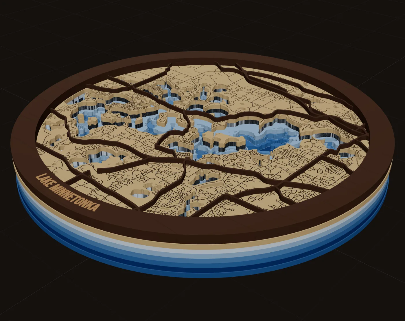
 Pieces to makeStacked multi-material mapsMix woods and acrylics in one layered map: water through land holes, contrasting tops, planned thickness.
 GuideHow to Make a Laser Cut Map: The Free Way and the Fast WayThis is how to make a laser cut map that holds together, reads at a glance and sells. We cover the free manual route with OpenStreetMap and vector software, the faster route in MappSmith, and everything after the file: crop, layers, wood, settings, glue and finishing. Use whichever route fits your shop. The craft is the same.Your machineMaps for LightBurnNative .lbrn2 files with cut, score and engrave on separate layers, plus a layered SVG for every sheet.
Make your first city street maps file tonight.
Search the place, pick the piece, check it in 3D, download files that open in LightBurn, xTool Creative Space and Glowforge.
7 days free, then $12 a month. Cancel anytime. Or 10 maps for $10.
— more from MappSmith
Everything else this app gives you.
Free tools, libraries and guides — most of it works before you pay for anything.